Article by Tony Roberts, first published in The Archer, May 1997.
An attractive feature of East Finchley today is its closeness to woodland, remnants of a much earlier extensive covering.
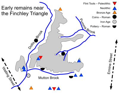
Following the retreat of the icecap the Finchley triangle was re-colonised by plants, animals and finally man. Early man would have found the area forested and difficult and there is nothing to suggest any clearing might have taken place before 5000 BCE. Early travellers left evidence of passage, from early stone age flint tools in the centre of the triangle, to late stone age flints around Muswell Hill but there is no evidence of any settlement. The Romans visited the area too, leaving coins and pottery quite close by.
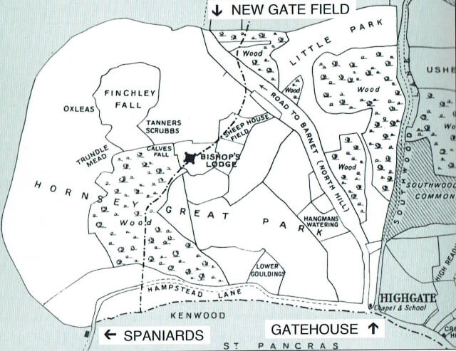
The Romans usually avoided the hilly northern heights, constructing straight roads in the valleys either side, Watling Street and Ermine Street, known today as the Edgware Road and Tottenham High Road. Even when the Romans left, the roads they left behind remained in use and most people had very little reason to venture into the woods covering Finchley. The nearest trackway was probably the early route of Hampstead Lane, before it was diverted away from Kenwood House, and which formed Finchley’s southernmost boundary.
Then came the Saxons up the River Thames to settle in its valleys. These middle Saxons were a loose group of tribes, dominated in turn by the Kingdoms of Essex, Mercia and Wessex. The name Finchley – clearing with finches – owes its name to them. King Alfred’s son Edward introduced the counties of Middlesex and Hertfordshire about 900 CE as a defence against the Danes and the middle Saxons were divided between them, the area now known as Finchley forming the northern border of Middlesex. The county was later divided into 7 or 8 administrative units known as “Hundreds” and Finchley was in the Hundred of Ossulstone, centred on London and with its court near Speakers Corner.
Reproduced by kind permission East Finchley Newspapers CIC
Acknowledgements: The Westminster Corridor, David Sullivan, 1994


